![](/images/other/stat-length.png)
![Percorso A piedi Le Havre - Autour du Cap - Photo](https://media.geolcdn.com/t/1900/400/ext.pjpeg?maxdim=2&url=https%3A%2F%2Fmedia.geolcdn.com%2Ff%2F5d7ac9de-0a46-49c7-8cfc-4f8d63e71135.jpeg)
Autour du Cap
SityTrail - itinéraires balisés pédestres
Tous les sentiers balisés d’Europe PRO
![Lunghezza](/images/other/stat-length.png)
Lunghezza
4,8 km
![Altitudine massima](https://static1.geolcdn.com/siteimages/upload/files/1508320355ic_sort_altitude_max_24dp.png)
Altitudine massima
97 m
![Dislivello positivo](https://static1.geolcdn.com/siteimages/upload/files/1508320355ic_sort_den_pos_24dp.png)
Dislivello positivo
101 m
![Km-Effort](/images/other/stat-length.png)
Km-Effort
5,9 km
![Altitudine minima](https://static1.geolcdn.com/siteimages/upload/files/1508320355ic_sort_altitude_min_24dp.png)
Altitudine minima
0 m
![Dislivello negativo](https://static1.geolcdn.com/siteimages/upload/files/1508320355ic_sort_den_neg_24dp.png)
Dislivello negativo
31 m
![Boucle](https://static1.geolcdn.com/siteimages/upload/files/16400158638029165_repeat_loop_refresh_sync_direction_icon.png)
Boucle
No
Tag
Data di creazione :
2022-02-15 02:14:22.737
Ultima modifica :
2022-03-02 10:44:07.095
![A piedi](https://static1.geolcdn.com/sitytour/trail-icons/100.png)
1h20
Difficoltà : Facile
![Scannerizza questo codice QR per aprire il percorso nell'applicazione SityTrail](https://capi.geolives.com/qq0zvz2zws4bq2lad0pu/sitytour/trails/3113760/qr.png?size=200)
Applicazione GPS da escursionismo GRATUITA
Chi siamo
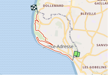
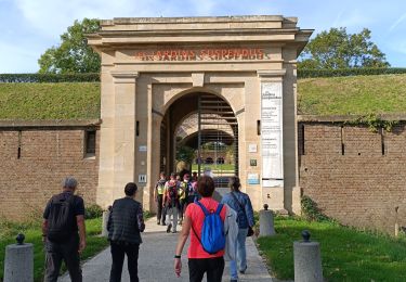
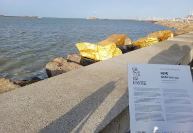
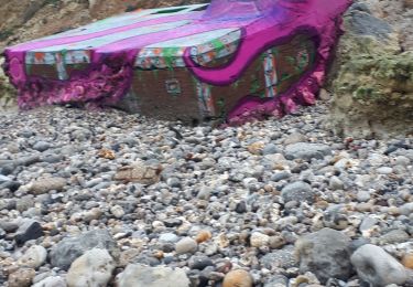
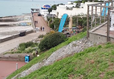
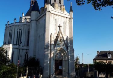
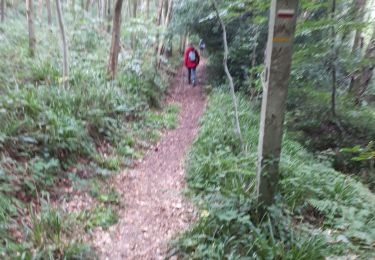
Percorso A piedi di 4,8 km da scoprire a Normandia, Seine-Maritime, Le Havre. Questo percorso è proposto da SityTrail - itinéraires balisés pédestres.
Descrizione
Trail created by CODAH.
Localizzazione
Paese:
France
Regione :
Normandia
Dipartimento/Provincia :
Seine-Maritime
Comune :
Le Havre
Località :
Unknown
Partenza:(Dec)
Partenza:(UTM)
289250 ; 5487105 (31U) N.
Commenti
Percorsi nelle vicinanze
![Percorso Marcia Le Havre - Découvrir Le Havre - Photo](https://media.geolcdn.com/t/375/260/ext.jpg?maxdim=2&url=https%3A%2F%2Fservices.sitytrail.com%2FGeolivesWS%2FDownloadMedia.ashx%3FTrailID%3D173067%26Media%3D14597_6.jpg)
![Marcia Marcia](https://static1.geolcdn.com/sitytour/trail-icons/101.png)
Découvrir Le Havre
Marcia
Difficile
(1)
Le Havre,
Normandia,
Seine-Maritime,
France
![](/images/other/stat-length.png)
14,2 km | 17 km-effort
3h 30min
![](https://static1.geolcdn.com/siteimages/upload/files/16400158638029165_repeat_loop_refresh_sync_direction_icon.png)
Sì
![Percorso A piedi Fontaine-la-Mallet - Les Bassins des Vallées - Photo](https://media.geolcdn.com/t/375/260/ext.jpg?maxdim=2&url=https%3A%2F%2Fmedia.geolcdn.com%2Ff%2Fce57ffe6-f4ea-486c-bc79-47861158f9a7.jpeg)
![A piedi A piedi](https://static1.geolcdn.com/sitytour/trail-icons/100.png)
Les Bassins des Vallées
A piedi
Facile
Fontaine-la-Mallet,
Normandia,
Seine-Maritime,
France
![](/images/other/stat-length.png)
5,1 km | 6 km-effort
1h 21min
![](https://static1.geolcdn.com/siteimages/upload/files/16400158638029165_repeat_loop_refresh_sync_direction_icon.png)
No
![Percorso Marcia Le Havre - 076-05-Le Havre A-Midi 9km - Photo](https://media.geolcdn.com/t/375/260/ext.jpg?maxdim=2&url=https%3A%2F%2Fmedia.geolcdn.com%2Ff%2Fd02b20a6-0462-4a95-b9ff-2029e3ab179d.jpg)
![Marcia Marcia](https://static1.geolcdn.com/sitytour/trail-icons/101.png)
076-05-Le Havre A-Midi 9km
Marcia
Facile
(1)
Le Havre,
Normandia,
Seine-Maritime,
France
![](/images/other/stat-length.png)
8,8 km | 11,5 km-effort
2h 49min
![](https://static1.geolcdn.com/siteimages/upload/files/16400158638029165_repeat_loop_refresh_sync_direction_icon.png)
Sì
![Percorso Marcia Le Havre - le havre parcs - Photo](https://media.geolcdn.com/t/375/260/ext.jpg?maxdim=2&url=https%3A%2F%2Fmedia.geolcdn.com%2Ff%2F96da9185-4728-4bbd-baaf-9500c4363780.jpg)
![Marcia Marcia](https://static1.geolcdn.com/sitytour/trail-icons/101.png)
le havre parcs
Marcia
Difficile
Le Havre,
Normandia,
Seine-Maritime,
France
![](/images/other/stat-length.png)
12,1 km | 14,5 km-effort
3h 25min
![](https://static1.geolcdn.com/siteimages/upload/files/16400158638029165_repeat_loop_refresh_sync_direction_icon.png)
Sì
![Percorso Marcia Le Havre - Le havre front de mer - Photo](https://media.geolcdn.com/t/375/260/ext.jpg?maxdim=2&url=https%3A%2F%2Fmedia.geolcdn.com%2Ff%2F3dca226e-3bee-4d91-903b-81db7c6a4339.jpg)
![Marcia Marcia](https://static1.geolcdn.com/sitytour/trail-icons/101.png)
Le havre front de mer
Marcia
Medio
Le Havre,
Normandia,
Seine-Maritime,
France
![](/images/other/stat-length.png)
8,2 km | 9,7 km-effort
3h 14min
![](https://static1.geolcdn.com/siteimages/upload/files/16400158638029165_repeat_loop_refresh_sync_direction_icon.png)
Sì
![Percorso Camminata nordica Sainte-Adresse - Le Havre plage - Photo](https://media.geolcdn.com/t/375/260/ext.jpg?maxdim=2&url=https%3A%2F%2Fmedia.geolcdn.com%2Ff%2F74f6e575-20b6-423b-8e0f-ed4b954898f3.jpg)
![Camminata nordica Camminata nordica](https://static1.geolcdn.com/sitytour/trail-icons/102.png)
Le Havre plage
Camminata nordica
Molto facile
Sainte-Adresse,
Normandia,
Seine-Maritime,
France
![](/images/other/stat-length.png)
7,2 km | 7,8 km-effort
2h 0min
![](https://static1.geolcdn.com/siteimages/upload/files/16400158638029165_repeat_loop_refresh_sync_direction_icon.png)
No
![Percorso Marcia Sainte-Adresse - Le Havre / la rue Edgard Faure / le lycée C Monet / l'escalier Lechiblier / la plage - Photo](https://media.geolcdn.com/t/375/260/ext.jpg?maxdim=2&url=https%3A%2F%2Fmedia.geolcdn.com%2Ff%2F371c4a6b-4d44-4f85-bfe0-443686b19764.jpg)
![Marcia Marcia](https://static1.geolcdn.com/sitytour/trail-icons/101.png)
Le Havre / la rue Edgard Faure / le lycée C Monet / l'escalier Lechiblier / ...
Marcia
Molto facile
Sainte-Adresse,
Normandia,
Seine-Maritime,
France
![](/images/other/stat-length.png)
7,5 km | 9 km-effort
2h 23min
![](https://static1.geolcdn.com/siteimages/upload/files/16400158638029165_repeat_loop_refresh_sync_direction_icon.png)
Sì
![Percorso Marcia Le Havre - Le Havre / Ste Cécile / La Vierge Noire / Le Bois Cody / Ste Cécile - Photo](https://media.geolcdn.com/t/375/260/ext.jpg?maxdim=2&url=https%3A%2F%2Fmedia.geolcdn.com%2Ff%2F200c0ec8-5f6f-4ba3-85ae-db69b7ff5e38.jpg)
![Marcia Marcia](https://static1.geolcdn.com/sitytour/trail-icons/101.png)
Le Havre / Ste Cécile / La Vierge Noire / Le Bois Cody / Ste Cécile
Marcia
Molto facile
Le Havre,
Normandia,
Seine-Maritime,
France
![](/images/other/stat-length.png)
5,2 km | 6,8 km-effort
1h 46min
![](https://static1.geolcdn.com/siteimages/upload/files/16400158638029165_repeat_loop_refresh_sync_direction_icon.png)
Sì
![Percorso Marcia Fontaine-la-Mallet - Le Havre: Forêt de Montgeon variante N°4 - Photo](https://media.geolcdn.com/t/375/260/ext.jpg?maxdim=2&url=https%3A%2F%2Fmedia.geolcdn.com%2Ff%2F8b15d953-6666-4ab2-ae83-cbcb0c4950af.jpg)
![Marcia Marcia](https://static1.geolcdn.com/sitytour/trail-icons/101.png)
Le Havre: Forêt de Montgeon variante N°4
Marcia
Molto facile
(1)
Fontaine-la-Mallet,
Normandia,
Seine-Maritime,
France
![](/images/other/stat-length.png)
8,5 km | 10,7 km-effort
2h 29min
![](https://static1.geolcdn.com/siteimages/upload/files/16400158638029165_repeat_loop_refresh_sync_direction_icon.png)
Sì